
Welcome to We R Survey, your trusted partner for cutting-edge CAD services that empower your projects with precision, efficiency, and innovation. Our experienced team of CAD professionals is dedicated to transforming your ideas into reality through state-of-the-art Computer-Aided Design solutions. Explore the seamless blend of creativity and technology with our comprehensive CAD services tailored to meet your unique requirements.
AUTODESK REVIT 3D BIM MODELING
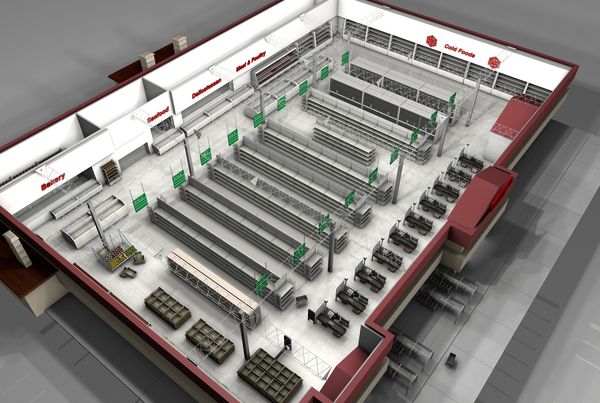
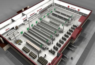
We R Survey is at the forefront of transforming survey data into highly detailed and data-rich Autodesk Revit 3D Building Information Modeling (BIM) files. Leveraging state-of-the-art surveying techniques and advanced technology, We R Survey excels in capturing intricate spatial details and translating them into comprehensive Revit models. The result is a meticulously crafted BIM representation that not only ensures accuracy but also incorporates valuable data, enriching the model with information crucial for project planning and management. This seamless integration of survey data into Revit provides clients with a powerful tool for visualizing, analyzing, and optimizing their projects. We R Survey's expertise in creating data-rich Revit models reinforces their commitment to delivering cutting-edge solutions that empower clients in the realm of 3D building modeling and project development.
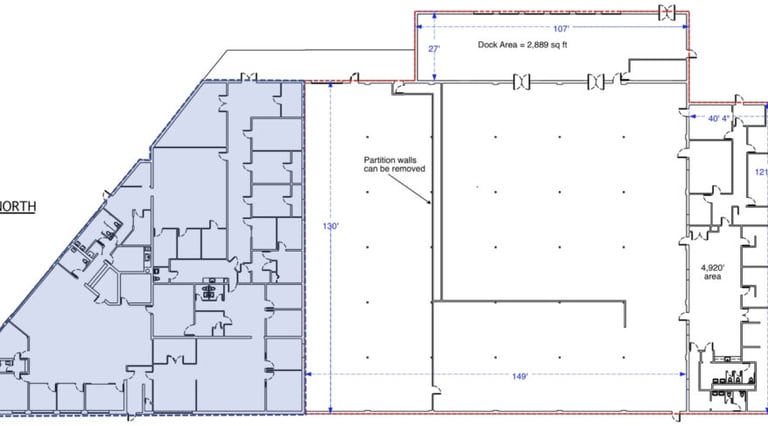
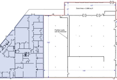
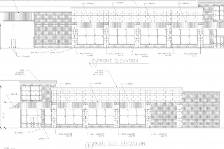
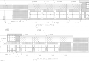
LEASE OUTLINE DRAWINGS (LOD)
We R Survey stands out as an industry leader in delivering Lease Outline Drawings (LOD) for commercial properties at an exceptionally affordable price point. With a commitment to cost-effectiveness without compromising quality, We R Survey employs advanced surveying technologies and streamlined processes to efficiently create detailed and accurate LODs for commercial leases. This service not only meets but exceeds industry standards, offering clients a budget-friendly solution for their property documentation needs. We R Survey's dedication to affordability makes high-quality LODs accessible to a broader range of businesses, providing them with essential tools for lease management and property planning without breaking the bank. In a market where precision and affordability are paramount, We R Survey's approach sets a new standard for accessible and reliable commercial property documentation.
CLOUD FILES XYZ, RCP, RCS
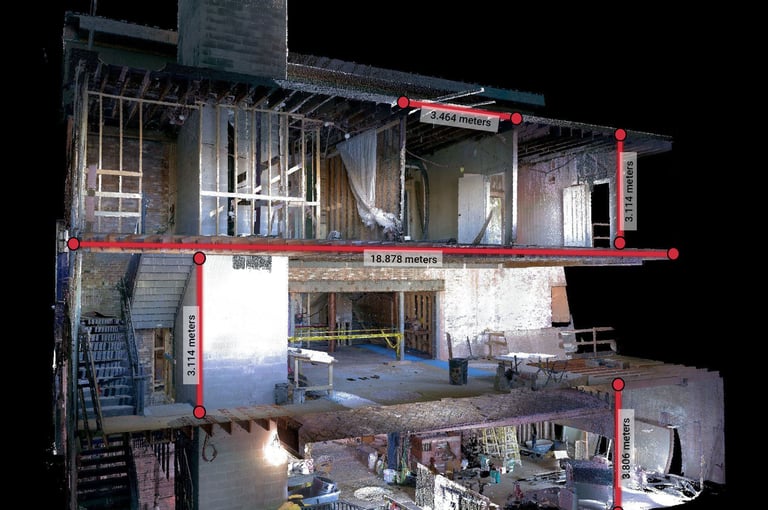
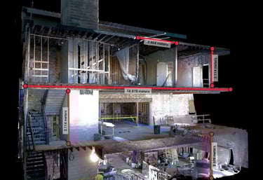
We R Survey revolutionizes surveying with an innovative approach, leveraging cloud files such as XYZ, RCP, and RCS extracted from our in-field scans. This cutting-edge technique enables unparalleled accuracy and facilitates cross-sectional views that were traditionally challenging to obtain. By harnessing the power of cloud-based data storage, We R Survey ensures seamless accessibility to detailed spatial information, granting clients the ability to delve into precise cross-section views effortlessly. This transformative process not only enhances the accuracy of survey data but also provides a level of insight that goes beyond traditional methods, offering clients a comprehensive and easily navigable understanding of their project's spatial intricacies. With We R Survey, the integration of cloud files unlocks a new dimension in surveying, optimizing data utilization and streamlining project analysis.
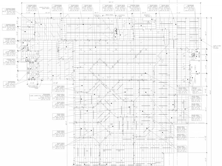
AS-BUILT PLANS
We R Survey excels in delivering the most economical solution for generating highly accurate as-built plans with swift turnarounds. Renowned for its commitment to affordability without compromising precision, We R Survey has positioned itself as the premier choice for businesses seeking cost-effective and reliable as-built plans. Through a combination of cutting-edge technology and an efficient workflow, the company ensures that clients receive meticulously detailed plans in a remarkably short timeframe. We R Survey's dedication to both accuracy and speed not only sets a new standard in the industry but also empowers clients with a budget-friendly option for obtaining precise and timely as-built documentation for their projects.
MATTERPORT TO CAD
We R Survey stands out as the industry leader in providing an exceptionally cost-effective solution for converting Matterport scans to CAD (Computer-Aided Design). With a commitment to affordability without compromising quality, We R Survey has strategically positioned itself as the go-to choice for businesses and professionals seeking seamless integration between immersive 3D scans and precise CAD models. The company's innovative approach ensures that clients can effortlessly transform Matterport data into accurate and detailed CAD representations at a fraction of the cost compared to other providers in the market. We R Survey leverages cutting-edge technology and a streamlined process to deliver unparalleled value, making advanced spatial data accessible to a broader audience. In a landscape where precision and affordability are paramount, We R Survey's solution for Matterport to CAD conversion sets a new standard, empowering users to unlock the full potential of their spatial data without breaking the bank.

CONTACT
ADDRESS
4012 Gunn Highway, Ste 100
Tampa, FL 33618
HOURS OF OPERATION
Monday - Friday: 9:00AM - 5:00PM
PRIVACY POLICY | TERMS & CONDITIONS
© We R Survey